
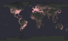
All The Known FM Radio Transmitters In The World.
(Source: reddit.com)
Related Posts
![Ammassalik wooden maps: carved, tactile maps of the Greenlandic coastlines made by Inuit, 1884.
[[MORE]]
Ammassalik wooden maps are carved, tactile maps of the Greenlandic coastlines. In the 1880s, Gustav Holm led an expedition to the Ammassalik...](https://64.media.tumblr.com/dd84045b305144bfd36c9c7a9e2bad53/tumblr_nhp29kU2SU1rasnq9o1_100.jpg)

![Size of Downloadable US State Maps on Nokia Maps App
[[MORE]]KaptainKielbasa:
I know interactive maps are passe, if someone wants to do a mock-up and present all the data in a nice form, I am perfectly fine with that! I’m also going to look at...](https://64.media.tumblr.com/0fcb3d89d4fb9ce8af3c25789b05fd26/tumblr_nj3v6rCwws1rasnq9o1_100.png)

 bigheaddck liked this
  idk-why-again reblogged this from mapsontheweb
  clownspouse liked this
  indo-mie liked this
  nu-goth liked this
  pasonik liked this
  oceansprittz liked this
  robinscherbtsky reblogged this from mapsontheweb
  abedsnerdir liked this
  specialtrampdanascully reblogged this from harrys-place specialtrampdanascully liked this
  massivecloudwombat liked this science4danger liked this
  djkiwi reblogged this from mapsontheweb
  chilldude69-blog1 liked this chanabooboo liked this bobong23b liked this
  galaxitta liked this
  alohaquizzer reblogged this from mapsontheweb